

Drone-based habitat mapping takes off
August 23, 2018
Unmanned Aerial Systems, or drones as they are commonly known, have quickly become an invaluable high-tech tool for ecologists and conservation managers to acquire highly accurate and detailed information about landscapes and habitats. Drones also enable habitat data to be collected rapidly and in a very cost-effective manner.
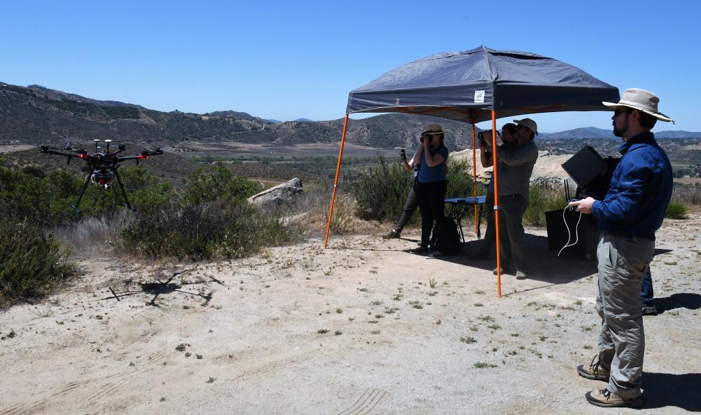
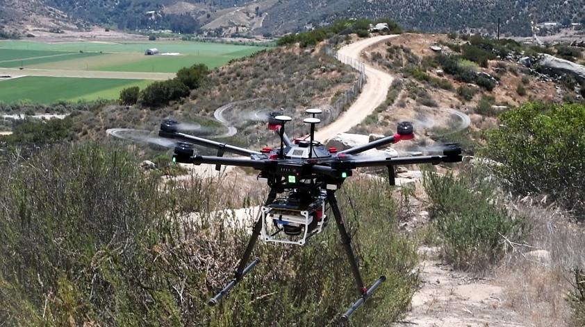
Recognizing the increasingly utility of drones for conservation research, scientists from the San Diego Zoo Institute for Conservation Research recently partnered with engineers and programmers from Northrop Grumman Corporation and Slingshot Aerospace to develop a custom drone that could be deployed in a variety of challenging environments.
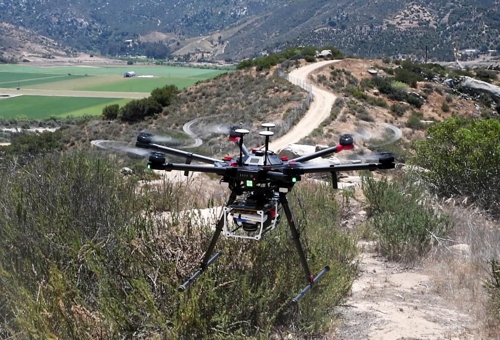
Our conservation research drone can be easily transported to field sites, and its ability to takeoff and land in small areas means it can be deployed from rugged and remote locations. Another major strength of the drone is its sophisticated suite of highly-sensitive sensors that can survey in incredible detail the habitats we are interested in studying.
These sensors include a 51-megapixel visual camera for high-resolution imaging, a 5-band multispectral sensor to survey vegetation in different light spectra, a thermal infra-red sensor to detect animal heat signatures, and LiDAR laser sensors for scanning landscapes in 3D. The sensor suite has been integrated into the drone platform so that all the sensors can operate simultaneously, which obviates the need to re-fly the same area more than once.
San Diego Zoo Global manages a Biodiversity Reserve adjacent to the San Diego Zoo Safari Park in the San Pasqual Valley on behalf of San Diego County. The Reserve comprises 792 acres of important endemic coastal sage habitat that also includes one of the largest contiguous stretches of native prickly pear cactus. San Diego Zoo Global maintains an active role in restoring the Reserve, which has mostly recovered from the impact of the devastating 2007 wildfires.
To date, we have planted thousands of cacti and young shrubs as part of our efforts to restore fire-damaged areas of the area and we have recently hired a full-time Reserve manager to oversee our habitat restoration and management efforts.
A key component of any successful reserve management strategy is the need to inform management activities with robust ecological and environmental information. The San Diego Zoo Global conservation drone provides an exciting new way to collect landscape information and we have recently been using this high-tech approach to successfully survey and map out the recovering endemic vegetation in the Biodiversity Reserve.
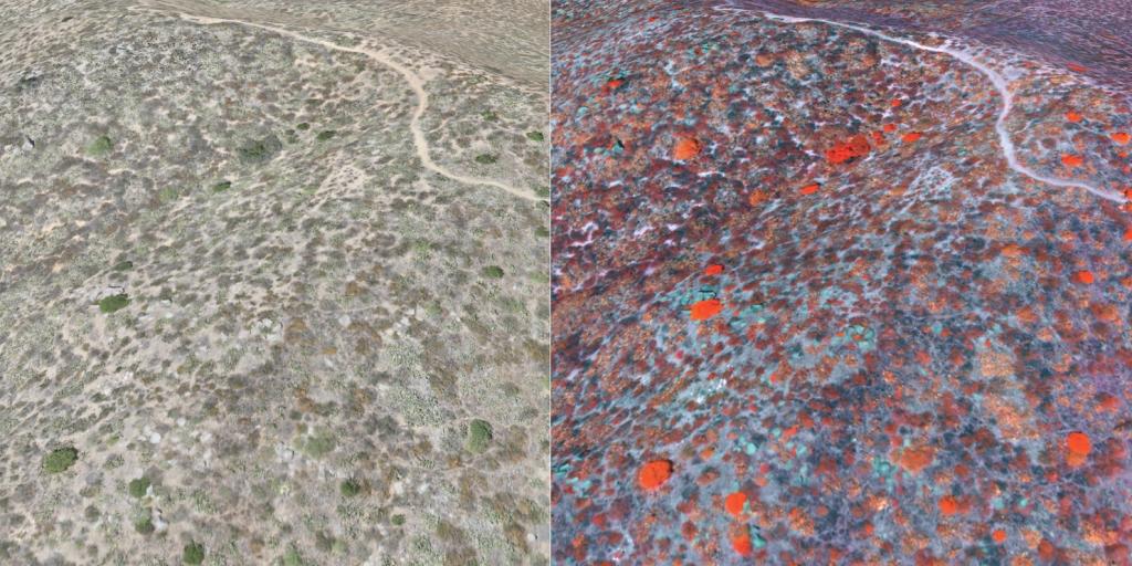
During each deployment, the drone travels along precomputed flight paths over the survey area at an altitude of about 260 feet (80 meters), pausing regularly to trigger its sensor suite and capture a wide range of detailed landscape data. We then use powerful software to process the many gigabytes of data collected by the drone during each flight and process and stitch them into high-resolution 3D digital maps.
These digital maps depict everything from vegetation density and the presence of weeds to the concentrations of chlorophyll in the plants. This information can in turn be used by the Reserve managers to guide our restoration efforts by providing detailed and up-to-date information on the health of the recovering native vegetation, as well as the spread of invasive plants.
Our development and deployment of this drone to survey and map important habitats is another example of how San Diego Zoo Global applies cutting-edge technology to help solve the world’s most pressing conservation challenges.